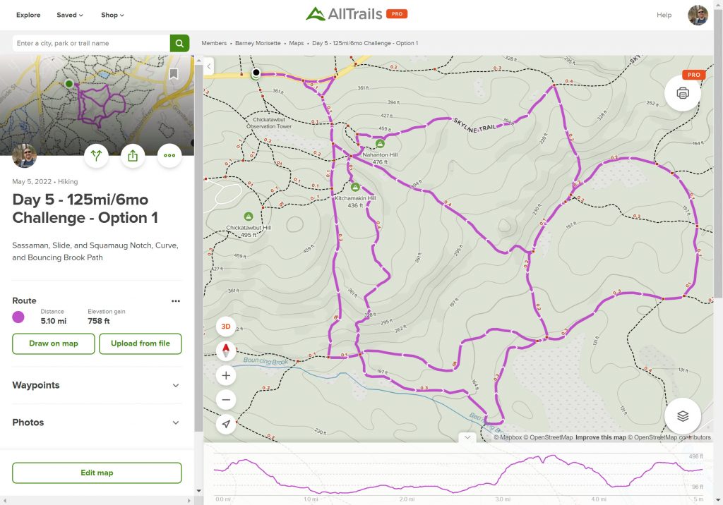
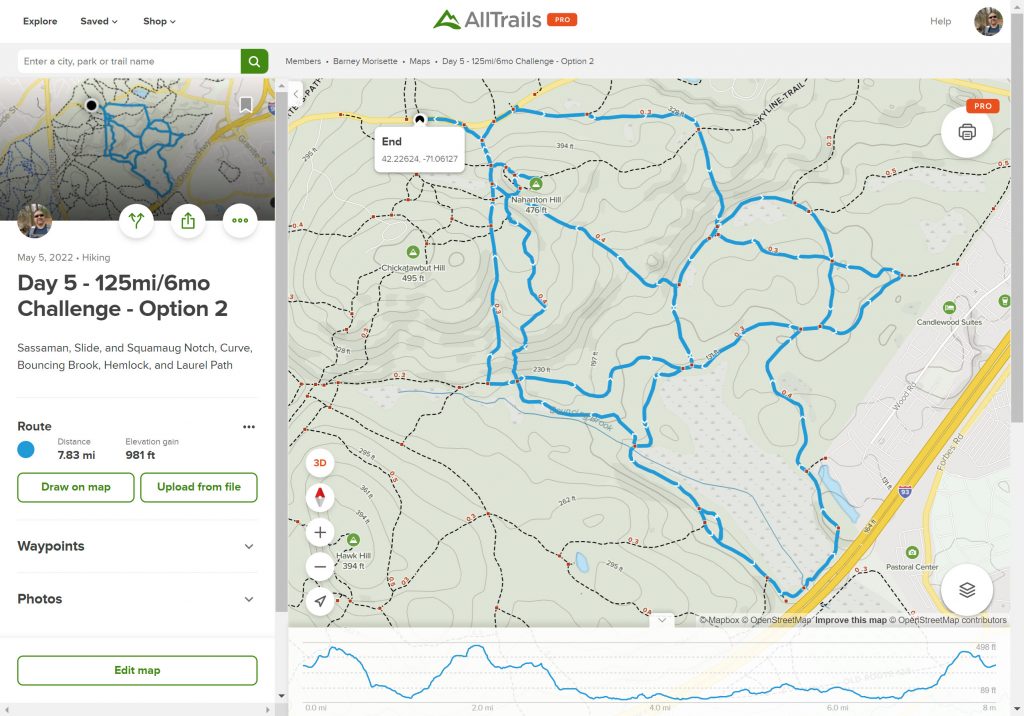
As soon as I finished my hike last Saturday I was already thinking ahead to next week. My plan on Saturday was to keep working on the 4000’s around the Furnace Brook area to build off my Day 3 hike around St. Moritz Pond. Then on Sunday I heard about the brush fire in the Blue Hills. It took a few days to figure out the rough area of the fire but when the news stations showed the aerial shots I noticed the array of solar panels near the fire trucks. With that in mind I checked out Google Earth and found that the solar panels were the ones near the Norman Smith EEC. With that reference point, it appeared that the fire was in the area between the Slide Notch and Sassamon Notch Paths. Yesterday my sleuthing was confirmed when the Friends of the Blue Hill shared a post identifying Saturday’s fire as the Slide Notch fire. Obviously, curiosity has gotten the better of me so this week’s plan is to hike the trails around the area of the brush fire to see how extensive the damage is. I have two plans worked up, one a 5 mile hike, the other one just shy of 8 miles. I’m pushing for the longer one, but my family may rebel and insist on the 5-miler or refuse to come. The results of this stand-off will be determined by Saturday morn.
Leave a Reply